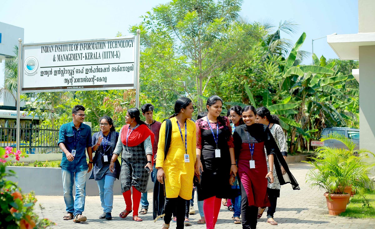
Geospatial Analytics

Geospatial Analytics

Master of Science in Computer Science with specialization in Geospatial Analytics course offered by the Indian Institute of Information Technology and Management-Kerala, aims at offering a high standard curriculum in allied disciplines of Computer Science. The programme focuses on a broad grasp of foundations in Computer Science, deep understanding of the area of specialization, an innovative ability to solve new problems, and a capacity to learn continually and interact with trans-disciplinary groups. The technology enhanced e-learning methodologies with web based course management system and on-line learning system enriches the programme, allow to broaden their horizons.

The duration of the programme is 2 years and the courses are carefully designed to attain technical aspects that enable the students to grow into geoinformatics professionals. There are 11 core courses, 4 electives and five lab courses. The students are required to do a minor project of 2 credits each during 2nd and 3rd semester. The students are also required to take one elective course during second semester and three elective courses during the third semester of 3 credits each. The 4th semester is for project/internship of 18 credits. Students are required to undergo an industry or research oriented project in any leading IT or R &D organizations. The total requirement for the programme is 72 credits.

Data analytics is one of the hottest trends in enterprises today. Companies are dependent on data analytics for a wide array of services and features which help the company achieve its goals faster and deliver utility to its customer in a timely manner. When conventional data analytics is powered with location and geospatial, it holistically takes care of the customer requirements. Geospatial technologies enhance the utility, functionality as well as the relevance of data analytics.

GIS tools have the unique ability to slice and dice terabytes of data in real time to derive decisive insights into understanding spatial trends and associations

There is a wide prospect of an increase in the use of spatial technologies. Geospatial data analytics is driving businesses and fostering innovation across different verticals. It also enriches the user by offering him a new perspective of data interaction by enabling users to recognize new patterns and connections, which can’t be showcased in traditional methods using graphs.

“Geospatial technologies enable a 3D view of business data through a map, the required spatial information can then be identified through latitude and longitudinal coordinates to extract demographic and customer information. This collaboration of tabulated data and locational data gives precise context by analyzing heterogeneous information available across complex system environments

Advantages over conventional analytics

Geospatial data analytics offers a host of advantages over conventional data analytics which doesn’t factor location. First of all, such an analysis that lacks the dimension of location and GIS would be incomplete and bereft of any insights. Often this data could be misleading as well or fail to provide sufficient information. The biggest advantage is the ability to visualize data, due to which one can deduce new perspectives and perceive new trends. The visual component can enable decision-makers to get intuitive insights to identify business opportunities

Geospatial Market

Geospatial analytics market is booming rapidly and shows promising prospects. As per the 2019 GeoBuiz report data analytics-GIS market is expected to touch $88.3 billion by 2020, growing at a CAGR of 12.4%

As per a study by MarketsandMarkets, between 2017- 2023, APAC will be the fastest growing region for extensive use of geospatial technologies to identify potential markets and drive strategic decisions in engineering, construction, mining, manufacturing, insurance, and agriculture. Currently, 3D GIS technology is being used in the development of smart cities across various South East Asian countries.

Alumni Details

IIITM-K has a good track record of placing its students in top-notch IT industries and research organizations. The institute has an active placement cell with several experts providing employment orientation and counselling for its students throughout the period of study. Most of Geospatial Analytics alumni are working at leading position with reputed organizations and IT companies. Following are some of the alumni details.

Alumni Batch Designation Organizations


I (2011-2013)

Associate GIS Engineer, Project Scientist, GIS Analyst, Hazard Analyst NeST IT, KSREC, Bluesky Geospatial Private Ltd, INCOIS, Institute of Forest Genetics and Tree Breeding


II (2012-2014)

GIS Assistant, GIS Analyst, Project Engineer, Business Operations Associate, Geoscientist Accenture, Geospoc Geospatial Services Pvt.Ltd, Kerala Institute of Local Administration-Centre for Human Resource Development, Kerala Infrastructure Investment Fund Board


III (2013-2015)

Project Assistant, Project Scientist, PhD Research Scholar CSIR-NIIST, Kerala State Remote Sensing and Environment Centre, AcSIR


IV (2014-2016)

Project Scientist, Geospatial Image Analyst, GIS Technician, Field Officer, Project Officer (CGARD Centre) NIRD, Antananarivo, Madagascar, Uxo-India, Kerala State Landuse Board, Centre for Geoinformatics-Kerala University


V (2015-2017)

Planning Assistant, Junior Engineer GIS, GIS Specialist, GIS Analyst, Data Engineer (Big Data) Kerala Forest And Wildlife Department, ICFOSS, District Planning Office, AMNEX Infotechnologies Pvt Ltd, Primera Medical Technologies Pvt Ltd, Hyderabad
VI (2016-2018) Geoinformatics Engineer, GIS Product Developer, GIS Analyst Infosys, SAC, MMS India

Eligibility

Entry-level requirement is a minimum score of 60 percentage marks OR CPI/CGPA of 6.5 or above in 10 points in the  Bachelor’s degree in any branch  of Engineering / Technology / Science  with  Mathematics as  a Subject of study OR Graduation /  Specialization in GeoSciences

A candidate with CGPA less than 6.5 will also be eligible if the equivalent percentage for graduation is above 60% as per the respective university norms for conversion from CGPA to percentage. In such a case, the candidate will have to produce the official document or percentage equivalence certificate from the respective university showing CGPA to percentage conversion norms, at the time of admission. Students who have scored less than 60% in their graduation degree are not eligible for admission to the courses of IIITM-K.

Candidates belonging to SC/ST communities are eligible for applying if they have minimum pass marks in the qualifying examination. SEBC candidates of Kerala State who are certified as belonging to non-creamy layer are eligible for 5% relaxation in the minimum required marks for qualifying examination, provided that the candidates have passed the examination.

Number of Seats

The number of seats for this program is 30.

Career options

  • GIS Executive
  • GIS Analysts, Programmers
  • Assistant Manager/Manager- GIS
  • GIS Technician
  • Project Lead – GIS
  • Photogrammetry Engineer
  • GIS Developer
  • GIS Data Analyst
  • LIDAR Technician


Major GIS Companies and Research Organizations

  • Indian Institute of Remote Sensing (IIRS) – Dehradun
  • National Remote Sensing Center (NRSC) – Hyderabad
  • Space Application Center(SAC) – Ahmadabad
  • National Centre for Earth Science Studies (NCESS) – Thiruvananthapuram
  • National Centre for Antarctic and Ocean Research (NCAOR) – GOA
  • National Institute of Rural Development(NIRD) – Hyderabad
  • Indian National Centre for Ocean Information Services(INCOIS) – Hyderabad
  • Rolta India Pvt Ltd – Mumbai
  • RMSI Pvt Ltd – Hyderabad
  • TCS, Wipro, Cognizant

Courses

The student is required to earn 33 credits from the following 11 core courses:

Elective courses

The elective courses are offered in the 2nd and the 3rd semesters. There will be only one elective in the second semester and three electives in the third semester.

Core courses

  • Computer Architecture, Organization and Operating System
  • Problem Solving with Python
  • Data Structures and Algorithm
  • Introduction to GIS
  • Foundations of Data Analytics
  • Principles of Remote Sensing
  • Web Technologies
  • Database Management System
  • Object Oriented Design and Analysis
  • Software Engineering
  • Spatial Data Analytics
  • GS Lab I ( Semester I )
  • GS Lab II ( Semester II )
  • GS Lab III ( Semester III )
  • Programming Lab I ( Semester I )
  • Programming Lab II ( Semester II )
  • Mini Project I ( Semester II )
  • Mini Project II ( Semester III )
  • Project & Viva Voce

Electives for semester - II

  • Geospatial Modeling and Analysis
  • Information retrieval
  • Predictive analytics

Electives for semester - III

  • Web Mapping and Web GIS
  • Geospatial applications Development
  • Big data Technologies
  • Blockchain technologies

Recent Recruiters

** Caterpillar India has registered for participating in the placement process of 2021 batch students.

What You'll Study

Reviews

Average Rating
5 based on

1 ratings

Detailed Rating
  • 5 Stars
    1
  • 4 Stars
    0
  • 3 Stars
    0
  • 2 Stars
    0
  • 1 Stars
    0

Leave Your Review

Course Instructors